The World Meteorological Organization says El Niño is firmly established and is expected to intensify into a very strong event, with climate impacts extending well into 2027. In its El Niño/La Niña Update for August 2026, issued on 3 September, WMO reported an “exceptionally high likelihood of nearly 100%” that the episode will persist through February 2027 — the first time the agency’s update has been so unequivocal, reflecting close agreement across its Global Producing Centres.
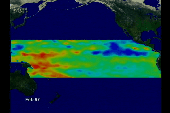
Sea surface temperatures in the central-eastern equatorial Pacific, tracked with the Niño 3.4 index, have risen sharply. The three-month average stood at about +1.5°C above normal for May–July 2026 and about +2.0°C in July. Weekly values between late July and mid-August ranged roughly from +2.2°C to +2.6°C above average. Below the surface, some areas registered anomalies of more than 8°C above average in July and early August, conditions WMO says support further strengthening before a peak toward the end of 2026.
WMO Secretary-General Celeste Saulo said the organisation is mobilising National Meteorological and Hydrological Services on a scale not seen in its 50-year history to deliver forecasts that can protect lives and livelihoods. United Nations Secretary-General António Guterres, quoted in the same WMO release, described the Pacific warmth as putting the world in a “danger zone of extreme weather” and called for accelerated climate action alongside preparedness.
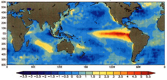
A very strong El Niño raises the odds of major shifts in rainfall, temperature and atmospheric circulation in many regions. WMO stresses, however, that event strength alone does not determine how severe impacts will be in any one country. Effects vary by location and season and can be reinforced or offset by other drivers, including conditions in the Indian and Atlantic Oceans.
WMO’s companion Global Seasonal Climate Update for September–October–November 2026 points to an increased likelihood of above-normal temperatures across almost all land areas, alongside rainfall patterns that show a pronounced atmospheric response to the Pacific El Niño. Multi-model forecasts also expect a positive Indian Ocean Dipole, with a seasonal mean near 0.9°C for SON 2026, while tropical Atlantic sea surface temperatures are forecast to remain generally above normal. The seasonal average Niño 3.4 ensemble-mean anomaly is projected near 3.6°C for SON 2026, with intensification peaking around November–December, according to the update.
Regional centres are already translating the global signal into local risk. The IGAD Climate Prediction and Applications Centre, working with national services across the Greater Horn of Africa, has flagged an increased chance of wetter-than-normal conditions in the last quarter of 2026. ICPAC cites a high probability of enhanced rainfall over parts of southern Ethiopia, central to southern Somalia and north-eastern Kenya — a pattern that can replenish pastures and water points but also raise flood risk, infrastructure damage and outbreaks of water- and vector-borne disease. Temperature outlooks for the same region point to warmer-than-average conditions over much of the east, including parts of Kenya, Ethiopia, Eritrea, Djibouti and Somalia. National Meteorological and Hydrological Services remain the authoritative source for official warnings and country-specific advice.
WMO notes that El Niño is a natural phase of the El Niño–Southern Oscillation and is not caused by climate change, though its impacts unfold against a warming climate background. Because the phenomenon typically peaks between November and February and can influence global temperatures into the following year, seasonal forecasts still offer governments, humanitarian agencies and climate-sensitive sectors a critical window for anticipatory action in agriculture, health, energy, water and disaster management before impacts intensify through early 2027.