
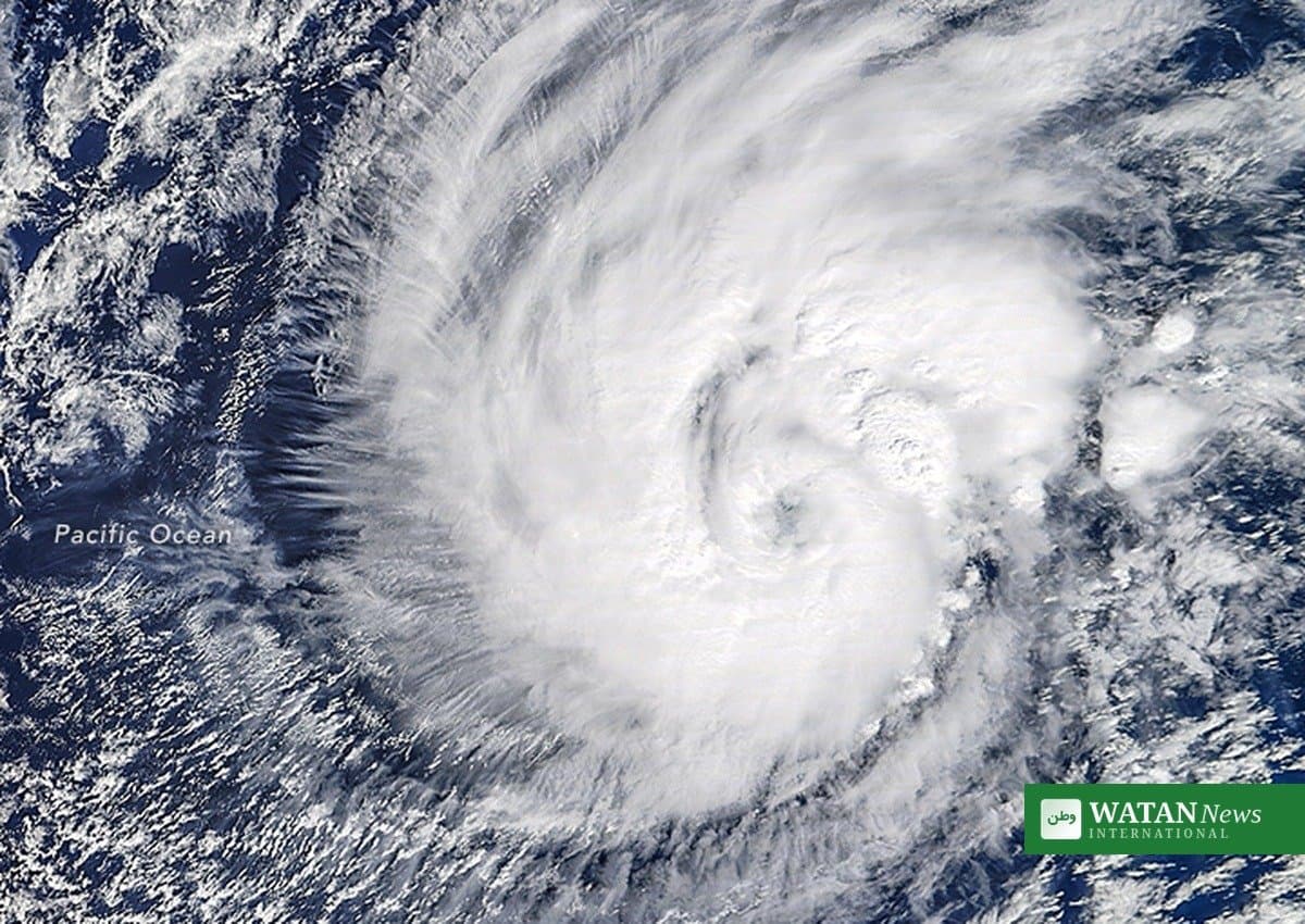
Hurricane Trudy Mexico is moving toward Mexico’s Pacific coast on Saturday, with the storm’s center forecast to pass very close to shore Saturday night into Sunday, threatening life-threatening flooding, landslides and dangerous surf in the states of Colima, Jalisco and Michoacán.
FAKTA
- Trudy rapidly intensified into a major hurricane on Friday, carrying maximum sustained winds near 120 mph (195 kph), according to the US National Hurricane Center.
- The storm’s latest NHC advisory holds it at 90 mph on Saturday, with some additional strengthening possible before steady weakening sets in late Sunday.
- The center is forecast to approach southwestern and west-central Mexico on Saturday and pass very close to the coast Saturday night into Sunday; a direct landfall is not expected.
- The NHC forecast 4 to 8 inches of rain in Colima and Jalisco, with isolated totals near 12 inches, and 2 to 4 inches in Guerrero and Michoacán — raising the risk of life-threatening flash flooding and mudslides.
- Mexico’s civil protection agency urged residents to secure doors and windows and prepare for possible evacuations; fishermen in Acapulco pulled their boats ashore as authorities closed some fishing and tourist ports to small vessels.
Hurricane Trudy Mexico: Rapid Intensification on Friday
Trudy rapidly intensified into a major hurricane on Friday morning as it churned toward Mexico’s Pacific coast, Reuters reported from Mexico City. The US-based National Hurricane Center said the storm was carrying maximum sustained winds near 120 mph (195 kph) and higher gusts, with additional strengthening forecast before Trudy neared the coast of Jalisco and Colima late on Saturday as a life-threatening major hurricane.
Alex DaSilva, a hurricane meteorologist at the private forecaster AccuWeather, said Trudy had the potential to even reach Category 4 or 5 intensity. “Everyone in this region needs to be very careful and stay alert over the weekend,” said the head of Mexico’s weather agency, Fabian Vazquez, at a press conference.
Weekend Forecast: Near-Coast Passage, Heavy Rain and Dangerous Surf
Today’s NHC track forecast has the storm moving northwest at about 7 knots, with its center coming very close to the coast of west-central Mexico. While some additional strengthening is possible on Saturday, increasing wind shear and drier air by late Sunday are expected to cause steady weakening, with the cyclone forecast to become a post-tropical remnant low early next week.
Even without a direct hit, the forecast track is expected to bring severe weather to southwestern and west-central Mexico: torrential rains, life-threatening surf and dangerous rip currents along the Pacific coast, and a gap-wind event in the Gulf of Tehuantepec producing gale-force northerlies and very rough seas. Officials noted that any change in the track closer to shore would increase the severity of the impact.

Powerful waves batter the Pacific coast as Hurricane Trudy nears Mexico — forecasters warn of life-threatening surf and rip currents through the weekend.
A Coast Already Battered
Trudy will strike a Pacific coastline that has already been battered in recent weeks by storms that left several people dead and caused severe flooding. “The most critical conditions will start on Saturday, with very severe winds and waves along the coast, in an area that has already been affected for several weeks,” Vazquez said.
Mexico’s civil protection agency asked residents to start preparations by securing doors and windows and removing objects that could be thrown around by the strong winds. Tropical Storm Simon, which had threatened Los Cabos earlier in the week, is meanwhile weakening to a remnant low offshore.
Watan News International will continue to follow the storm’s track. For more world coverage, see our world news section.