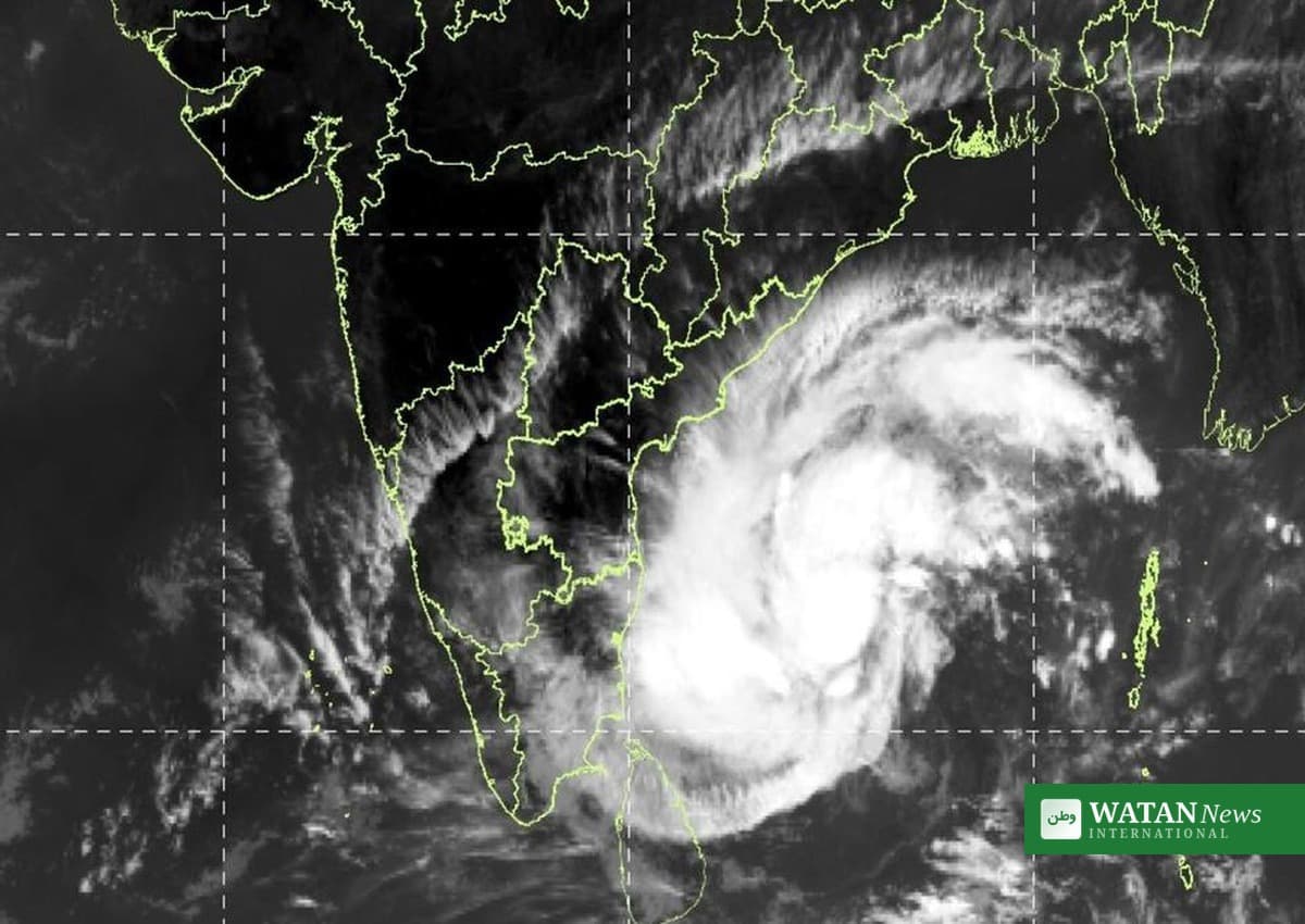
A deep depression over the Bay of Bengal will strengthen into Cyclone Akvan by Monday evening and strike the Andhra Pradesh coast as a very severe cyclonic storm by noon on Friday, 20 November, the India Meteorological Department (IMD) has said, putting India’s east coast on alert for the third time in under a month.
FAKTA
- System: A deep depression over the Bay of Bengal, to be named Cyclone Akvan once it reaches cyclonic storm strength.
- Landfall: Andhra Pradesh and Yanam coasts, between Nellore and Tuni, by noon on 20 November 2026.
- Peak winds: 120–130 kmph, with gusts up to 145 kmph.
- Position at 08:30 IST on 16 November: Near 11.2°N, 86.4°E — about 700 km east-southeast of Chennai — moving north-northwest at 6 kmph.
- On watch: Andhra Pradesh and adjoining south Odisha coasts; heavy rain also expected in Tamil Nadu and Puducherry.
Cyclone Akvan forecast track
The system concentrated into a deep depression over the southeast and adjoining southwest Bay of Bengal in the early hours of Monday. At 08:30 IST it lay centred about 630 km east-northeast of Trincomalee in Sri Lanka, 690 km west of Sri Vijaya Puram in the Andaman and Nicobar Islands, 700 km east-southeast of Chennai, 800 km south-southeast of Visakhapatnam and 910 km south of Gopalpur in Odisha.
According to the IMD, the system is very likely to intensify into a cyclonic storm over the central parts of the south and adjoining west-central Bay of Bengal by Monday evening, and into a severe cyclonic storm over the west-central Bay of Bengal by Tuesday evening, 17 November. It is then likely to intensify further and move west-northwestwards, crossing the Andhra Pradesh and Yanam coasts between Nellore and Tuni by noon on 20 November as a very severe cyclonic storm, with maximum sustained winds of 120–130 kmph gusting to 145 kmph.
The name Akvan was contributed by Iran under the regional naming system for cyclones in the North Indian Ocean. The IMD has issued a pre-cyclone watch for the Andhra Pradesh and adjoining south Odisha coasts, and district administrations have been placed on high alert, with a complete suspension of offshore operations advised.
Heavy rain and rough seas ahead
Heavy rain is expected to reach Chennai and neighbouring districts from Tuesday, 17 November, with thunderstorms, lightning and gusty winds of 40–50 kmph likely in Chennai, Tiruvallur and Chengalpattu districts. Heavy rain is also likely in Kanchipuram, Ranipet, Tiruvannamalai, Villupuram, Cuddalore and Mayiladuthurai districts and Puducherry from 18 November, while coastal Andhra Pradesh and south Odisha face heavy to very heavy rainfall from 18 November.
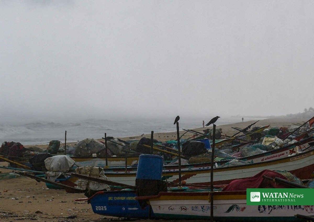
Squally weather, with wind speeds touching 50–60 kmph, may begin along the coast from Monday and increase gradually as the system intensifies. Sea conditions are very likely to be rough to very rough until 17 November, after which they will worsen, the IMD said.
Fishermen have been told not to venture into the sea until 20 November, and fishermen from Tamil Nadu coastal areas have been advised to stay ashore from 16 to 21 November. In the 24 hours to 05:30 IST on Monday, Tuticorin recorded the heaviest rainfall at 20 mm, followed by Nagercoil and Kanyakumari with 10 mm each.
Third cyclone in under a month
Akvan would be the third cyclone to threaten India’s east coast in under a month. Very severe Cyclone Arnab made landfall near Narsapur in central Andhra Pradesh, and severe Cyclone Murasu made landfall near Ongole in south coastal Andhra Pradesh.
Arnab caused damage worth ₹307 lakh to fisheries in Visakhapatnam district — ₹123 lakh in partial damage and ₹184 lakh in full damage — while no damage was recorded during Murasu, according to the fisheries department. Fishermen’s leaders say the recurring weather disruptions have crippled livelihoods during the Karteeka Masam season, when fish sales already slump.
The forecast landfall stretch covers about 500 km of coast — nearly half of Andhra Pradesh’s 1,053-km shoreline — with Machilipatnam sitting roughly in the middle. Krishna district, of which Machilipatnam is a part, has seen devastating cyclones in the past, including the 1977 Diviseema cyclone, although the district was spared much of the damage during Arnab and Murasu.
What happens next
The IMD’s next bulletins will be the most important to watch, as forecasts for cyclones can change quickly and the exact landfall point may still shift. Initial forecasts had pointed the system towards north coastal Andhra Pradesh; the latest bulletin places its landfall in central and south coastal Andhra Pradesh instead.